Saturday 30 June 2012

Thursday June 28th. To the island (apologies to Mr R Stowe)


With an early (no breakfast) start we headed for the ferry from Horseshoe bay to Nanaimo on Vancouver Island. We had planned to catch the 8.30 and our timing was just right. I had actually been on this ferry before… if you go to Google Maps Street View and follow the arrows from Horseshoe Bay you get a view from the Google car in the bowels of the ferry. A 
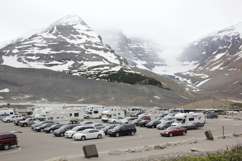
lovely 2 hour trip ensues and the views are fantastic. Seaplanes and ferries make for a wonderful foreground to an impressive backdrop of fjords, inlets, islands and distant snow caps. 


The waters here are calm, and there were a mix of passengers from locals (calmly using laptops as if they had seen the view a thousand times) and us others, cameras ready and braving the very relaxing decks. The weather was overcast, but fortunately not raining.

But rain it did.

We were heading through Nanaimo on the highway but had to do some essential shopping. I had never been to a Walmart, so this was our chance. This is the Auchan of Canada… huge, and reminded me of the Auchan store in Avignon. (Very hard not to sound pretentious when writing about such comparisons.. we are so lucky to have travelled as much as we have over the last few years). As W said, "This is like a Supermarket with a Kmart attached". We got what we wanted, photographed the guns and left.


The rain started and slowly intensified throughout the day. Crossing the island towards Tofino was again a serpiginous route with its ups and downs and the slow uphill groans and roaring descents. The "check engine" light comes on every now and then, disappearing when it wishes. We ignore it. This is "the boy who cried wolf" if ever I have seen it. One descent was 18%. That's impressive.

In drizzle and plonking rain we finally reached the west coast and we were in the Pacific Rim National Park. The visitors centre warned us about several hazards. There was one region sealed off due to unexploded munitions, a warning about cougars and wolves, and another about Tsunamis! It's really strange driving through coastal forest, without a view of the sea and coming across "Warning- Tsunami Zone". I must look up what happened here after the Tsunami in 2011.

Just looked it up.. nothing much actually happened, but they were a bit worried for a while..
Article here

We had used Skype to book at the Crystal Creek Resort for two nights and we motored into our secluded home. A lovely place, upmarket and well maintained. Free Wifi… usual deal.. almost unusable and for some strange reason undetectable by iPads. I think the superior antenna in the Macbook Pro was the factor that made a difference.


Despite the rain which was now steady we all went down to the beach and wandered along the adjacent MacKenzie's beach. We found a little trail into Pacifica something-or-other Park and Mary and I decided to walk the couple of kilometres into Tofino proper. V and W had enough sense to turn back. Wet and squelchy, Mary and I used the bike trail, only disturbed occasionally by cyclists, many still in wetsuits and carrying surfboards.

In Tofino we came across a store where there were some walking boots of my size on special. These were no $12 no name sneakers- they were Merrell's leather and gore tex boots for $96 plus tax. 


Yep, that's the one - from another site
They were really comfortable and my sneakers were starting to get wet, so new boots with comfy socks was a simple comfort that made all the difference on the return trip. Cosy and steamy in the RV we settled for the night.

The internet became reliable at 10.30 which enabled me to check our finances. We are way over budget. We only had $62 left in CAD in our special travel card for this trip. Good to know as we had been using it in ignorance, assuming a higher buffer… would have been embarrassing to produce it and have that old chestnut "Insufficient funds" appear.

Wednesday June 27th. Out of the desert and a jerky experience.


Westwards was the direction we needed to head. The countryside remained as it had been the previous evening.. Very dry and desert like. Eroded hills, sparsely treed, and often bare, except for an occasional lone burnt out or broken-off dead pine. There were several areas where fire had stripped all but the remaining blackened tapering trunks; a see through  forest of charcoal spikes.


The road here is narrow by Canadian standards. Generally their roadways are vast expanses of bitumen, but here you have to watch your boundaries lest you lose a mirror in a duel with oncoming beasts, or tear a flank on the barriers of the verge. Occasionally the barriers disappear and the flank-side anxiety of impact is replaced by plummet-o-phobia. Racing rivers directly below, silenced by the distance, still look menacing.


In a rare piece of roadside greenery
The vehicle groans on the ascents, which are steep and it roars painfully down the descents as it automatically gears down. One descent was 13% which felt quite steep indeed.


This was not a road for fast travel. This was going to be a long travelling day again. This is one of the real catches in RV-ing.. the distances here are vast, and if you decide you want to see a lot (which we did) you end up sacrificing many days getting from A to B. No, I wouldn't do it again, but it's a reasonable compromise for travelling with adult children. But it does involve compromises, as any close family living does. We often have different ideas about what we want to do, and both V and W have compromised their sleep-ins in the interests of harmony with us oldies.


Suddenly the terrain changed as if we had emerged from a rain shadow back to verdant British Columbia. The rivers looked the same, but the surroundings were now forests again, and the horizon slowly populated with tall green-blue peaks with caps of white. 


We hadn't been expecting to see snow again after leaving the rockies. We were headed to the environs of Whistler today, heading via Pemberton. The route into Pemberton was lovely, but what became obvious was that the approach valley was a poor area and the local population was predominately non-Caucasian. We are pretty sure that these were the pre-colonisation locals, many of whom seemed relegated to subservient jobs and very humble dwellings. Just short of Pemberton we filled up with gas (the environmental cost is another reason I don't think I will ever RV again) and chatted with the attendants in the store who were interested in where we had come from. They were lovely and friendly. It seems all of Canada we have encountered has with it a good dose of "welcome".

At Pemberton I made a very thoughtful purchase of some jerky for William. He refused it and asked if I was serious. Here it is….


There was much amusement in the grocery store when I took it back for a refund and explained why. The checkout people and other customers were still laughing as I left. I needed to leave this town and never come back! 


Some graffiti at Pemberton
At the tourist information centre we bumped into some other RV people heading in the opposite direction. The centre had no information for them about the Rockies, but we had an excess of accumulated brochures, guides etc. We gladly disposed of them.. doing our bit for recycling. The recipients were also grateful.

Whistler! What a place. This is definitely Vancouver's winter playground. Impressive lodges and much has been put into attracting the tourism. We did a quick circuit of the town, but had decided that Vancouver Island was pulling like a magnet, so we pushed onwards to Squamish.

The Squamish Eagle Vista RV park is lovely, and Janice, one of the owners was cheerful and helpful. Once again, "Free Wifi" doesn't always mean much. These parks are not set up for the demand and the internet dropped in and out at will. Our original site had no access so we had moved close to the source, but even then it was flaky. We did the essentials on the internet, which was mainly banking and essential emails. No way I could post the blog efficiently. Somehow Canada seems a bit like France regarding the internet.. it's more like Australia was 4 or 5 years ago.

Wednesday 27 June 2012

From the Rockies to Middle British Columbia


Another travel day. Imagine some clever novelist had put all of their effort into making a road trip into an engrossing read... Then consider the following as a contrast;

We drove and drove and drove to Cache Creek. The end.

Actually there are a few points about today's drive worth recording. The first is the sad story of a "logging town in transition" : Valemount. We had stopped here for supplies. It's on the highway number 5 on the main route from Jasper to Kamloops. You have to exit the highway to drive the main street. The first thing I noticed was that there were a number of buildings that looked disused and that the local department store had a closing down sale "Everything must go". The shelves were quite depleted but there were still some bargains to be had. I picked up an unlikely combination of three tins of smoked mussels and a pair of sneakers for a grand total of $12.45. They even had some reasonable black shoes for $20 but Mary dissuaded me (rightly too.. I had brought my own black shoes which needed only a polish)

Back to Valemount and its plight. The atmosphere in the store was depressing. A young man at the checkout was lamenting his misfortune "how am I going to pay the rent now?". A woman was emptying stock from the shelves and there was no smiling going on. It made me realise how friendly and cheerful most Canadians are because the absence of cheer here was palpable. A wander through the streets later revealed that the decline of the town was a big and explicit issue. Postings in the windows of the closed retail buildings referred to the transition and one shop looked like it was about to reopen as an art gallery. The town seemed to have shifted it's hopes from logging to tourism, but I couldnt see enough of the "critical mass" you need to make this work. The town just isn't big like its rivals. I hope for the locals sake they can make a go of it. Here's a photographic tour of the town.


We did find one focal point though. Hidden behind an ignominious shop front was a friendly little coffee shop. Although they burnt the coffee, this was worth it as the atmosphere was one of friendly chatty conviviality. We enjoyed a coffee each and W had a drink which was pretty much identical in taste to a vitamised Billabong icy pole.

After Valemount it was all downhill, literally. We followed the North Thompson River for kilometers and kilometers. This descent was to finish at Kamloops where we would divert in a westerly direction, heading towards Whistler. There had been some debate about whether we would stay in Kamloops but once we see it we knew that this was not the place for us. It was vast, industrialised, surrounded by denuded hills and plastered with billboards. W's comment was "if they go to so much trouble to build a billboard why do they fill it with this s**t so that you want to shoot yourself in the head when you see it?"


Once you leave Kamloops you enter "the desert of British Coumbia". It's not really a desert but we did pass a complete movieset of a Western town. Clint Eastwood would have looked totally at home in it. Here's some shots from the vehicle of the landscape.


We were very enticed by a park called Brookside which advertised free Wifi as we had been starved of connection for days. A lovely little park. The only problem was the Wifi. It doesn't work... much....at all. Our reactions to this problem cannot be published. We headed out to celebrate my birthday to the Sandman "restaurant". This is really a cafe. The serving sizes were enormous! We wolfed down our Greek food (Greek Style Roast Lamb, Grilled Salmon, Greek Salad and Fries +++, and Manie's Burger). I enjoyed an Okanagan beer. 


We returned to the park and wrestled with the internet. There were moments of blinding functionality interspersed with total disconnection.. it was a minute by minute affair! The cry of "the internet's really fast again" was met with the rapid chatter of keyboards and flurry of fingers on tablets until the simultaneous "Oh no, it's down again!"

It at least enabled me to post my blogs (text only- no way could it handle photographs)


It's my birthday.. I got a surprise cake
Very late at night the internet became reliable. (we investigated the problem earlier by interrogating the Router log and saw how many people were connected and disconnected.. it's happening to everyone every few minutes) These last 6 days postings are thanks to a very very late internet session.That's why there are now photographs in this blog now!

The ice parkway.. AMAZING


For the first time we actually did start early, not that it helped. As we left the campground the driver wheel was making a grating sound with each revolution. Inspection didn't reveal anything. We rang the company from the carpark at Lake Louise Community. They were busy and vowed to ring us back. A coffee later and we had lost 45mins and they hadn't rung. We decided to push on and monitor the problem. Within about 5km the sound was definitely much diminished and soon it was completely gone.

We missed the turnoff for the Ice Parkway and lost another 20mins. Mary had a not-very-happy-attack as we lamented the lost opportunity.. the weather was perfect: blue skies and sunny. The drive should be glorious. It was as it turned out. I was really thankful we had the GoPro set up, and we actually set it to take a picture every 5 seconds through the front windscreen. I kid you not, many of these photos will be wonderful to look back on.

Words can do little to describe the beauty of this drive, so I will let pictures do it.

Believe it or not, that's a black bear
Peyto Lake

Bingo- nearly a full house of Cruise Canada RVs
Mistaya Falls

Mistaya Canyon 


The weeping wall from afar


By lunchtime we had reached the Centre at the Columbian Icefields. Mary and W headed out onto the glacier while V and I enjoyed a cafe meal and reading in the van.


Yep, that's a glacier
Yep, that's a glacier too.

The Ice Parkway Centre is popular

Mary and w returned from their glacier expedition spouting superlatives such as "OK" and "interesting". Apparently there was a lot of waiting around but the highlight for Mary was the vehicle they travelled in onto the glacier : it navigated a 32 degree slope downwards which was quite a thrill!

V and I had enjoyed our cafe meal; myself more than V unfortunately as her vegetarian noodles were more noodle than vegetarian, and a bit greasy at that. My beef pie and green salad was excellent. Once fed, we returned to the van and I did some blogging. We still were cut off from the www and W was starting to get withdrawal symptoms (so was I, I confess).

After the return of the glacial ones we departed again. The scenery remained spectacular, but there's only so much ooohing and aahing you can do in a day and we actually sped past a few sights, saying "should we stop?"..... "no, we all saw it didn't we?"

One place we are really glad we stopped for though was Athabasca Falls, an incredibly impressive display of the immense power of a whole river in semi flood forced over narrow falls then into a very narrow gorge. Thunderous, powerful, blasting, reverberating forces of nature!


There are two roads to Jasper from here. We took the back road as recommended by Lonely Planet. This was a good recommendation as the road was lovely. It is sealed, but not maintained as well as the main highway so the first 8 km are a bit bumpy, but the solitude is worth it after the high traffic of the main highway through the ice fields. It was getting late and we were undecided about whether to stay in Jasper or to move on. We hadn't paid for another night in the National Park and we were a bit keen to keep moving and use any gained time on Vancouver Island, but this had been a big day and Mary was tired. Once we saw Jasper the decision was made: not to our liking and nowhere near as picturesque as Banff. It really isn't Jasper's fault; it's just that a broad windswept valley and a shopping strip on one side without any counterpoint on the other (on account of the railway line and lake) doesn't provide the sense of welcome that Banff does. I think it's the lack of an actual centre that makes the difference; no definite centre, no feeling of heart.

So we pushed on. Our destination was Mount Robson, as we had seen in our guide that there were a couple of RV parks. It was only 80km away and out of the National Park. 


A beautiful view approaching dusk


Looking for a place to stay on the road in Canada? There's an app for that! Well not exactly, but the free app simply called "Canada" has free downloadable contour maps and although it is only for iPhone, the maps are more than adequate on the iPad. I thoroughly recommend this for anyone traveling in Canada. Some preparation is required though.. The maps are not built in to the app; you basically have to download them individually and as they are 1:50,000 our trip involved several hours of downloading prior to leaving Australia and another couple of hours from our apartment in Vancouver. The point of all of this was that this app also showed a tantalizing symbol on the exit side of town..

This symbol indicated a campsite and on investigation, four travel weary road hardened late arrivalists discovered their Shangri-la; a lovely campsite hidden in a tall pine forest. If not for the density of mosquitoes, it would be perfect! Mosquitoes, by the way are worth a mention. If you are traveling in Canada in Summer be warned. You will find water everywhere and that means you will also find mosquitoes everywhere. We had paid extra for outdoor chairs. I think the locals must hire these as a bit of a practical joke. There's no way I am sitting out on them. It would be equivalent to painting a target on your back and sitting in a deck chair on a rifle range.

Nestled in the pines we had a late dinner and collapsed into bed to sleep soundly.